Before wind turbine is installed, a feasibility study must be conducted to determine whether a proposed site is viable for a wind farm. One of the most critical components of this study is understanding the wind resource – how strong, how consistent, and how suitable the wind is at a specific location.
Site selection plays a major role in the success of any wind energy project. The developer need to know where is the best place to install wind turbines, and is the wind strong and consistent enough to make this investment worthwhile? To answer these questions, accurate wind data is essential – not just for engineering design, but also for economic modelling, financing, and long-term energy yield forecasts.
Traditionally, wind measurements are taken using a meteorological (met) masts, equipped with:
- anemometer to measure wind seed
- wind vanes to detect wind direction
- installed at several specific heights (e.g., 60m, 80m, 100m)
While this method is proven and reliable, it also comes with challenges:
- high installation and maintenance costs
- Long permitting and construction time
- Fixed in one location
- Difficult to deploy in remote, offshore, or mountainous areas
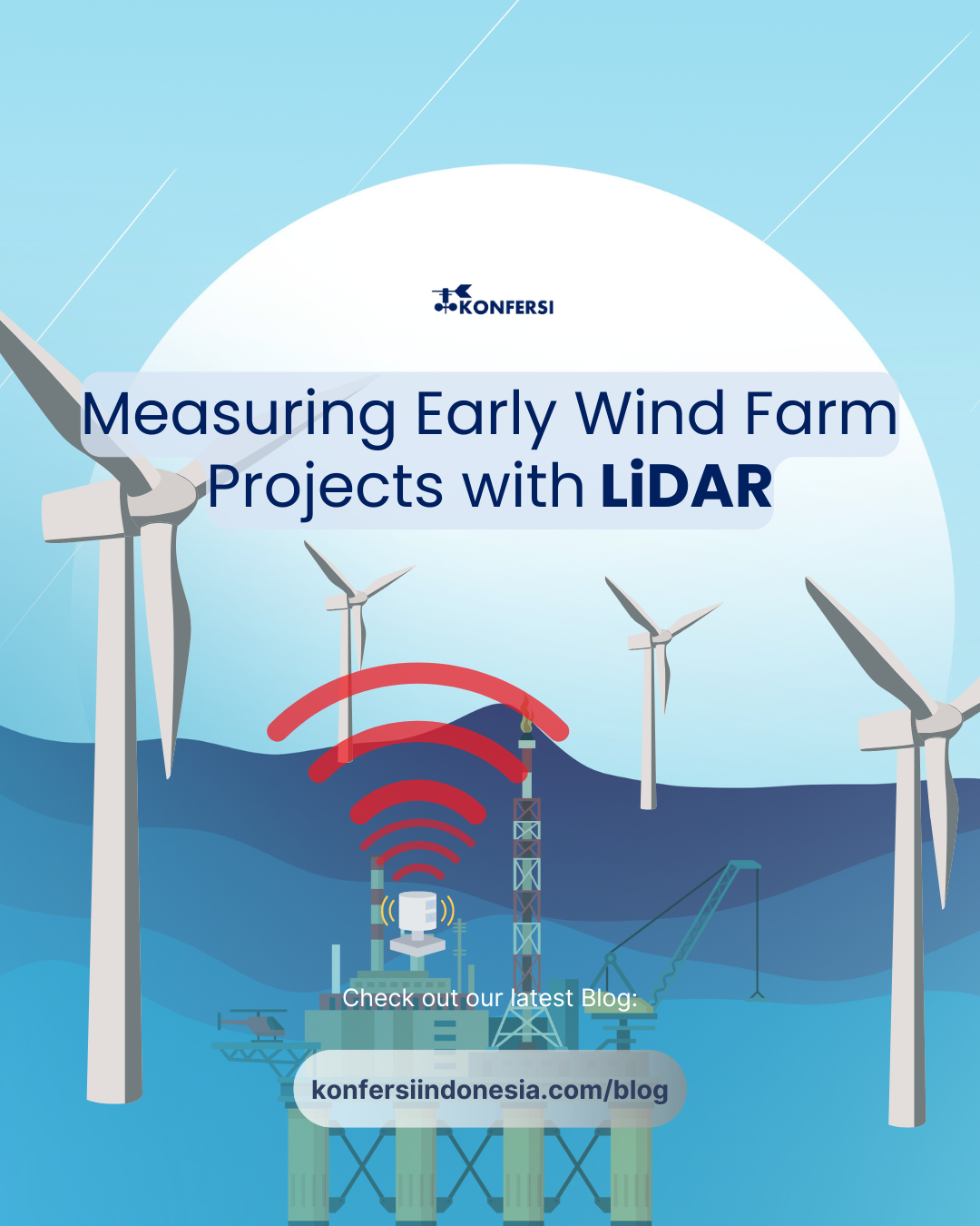
To overcome these limitations, the wind energy sector increasingly uses LiDAR (Light Detection and Ranging) technology.
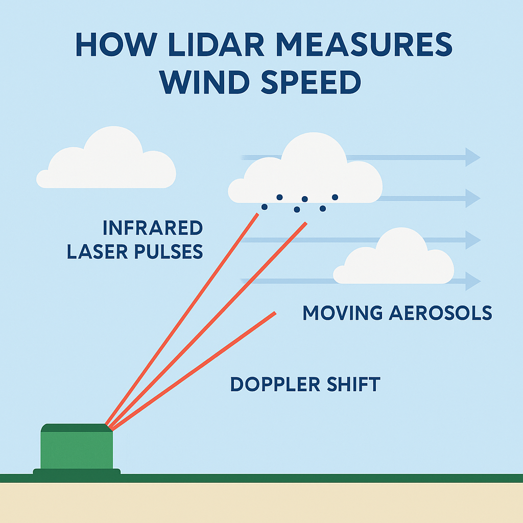
Here’s how LiDAR works:
- A LiDAR system emits infrared laser pulses into the atmosphere
- These pulses hit aerosols (tiny particles like dust or moisture) that move with the wind
- When the lase light is reflected back, it experiences a Doppler shift – a change in frequency caused by the movement of the particles
- By analyzing the Doppler shift, the system calculates:
- Wind speed
- Wind direction
- Turbulence and wind shear
- The process is repeated across several angles, giving a full 3D profile of wind conditions at multiple heights, up to 200-300 meters above ground
The Doppler effect in LiDAR, it refers to the change in frequency of the laser light when it calculate wind velocity – even at great distances and altitudes.
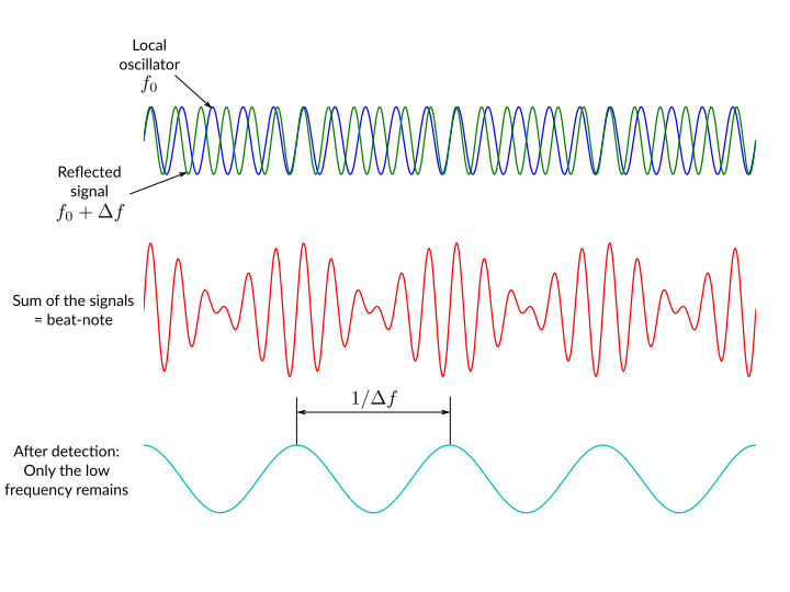
| Element | Represents | Purpose |
| Green Wave | Doppler-shifted return | Signal from moving air (e.g., wind) |
| Blue Wave | Local oscillator | Internal reference for comparison |
| Red Wave | Mixed signal | Shows beat pattern due to frequency difference |
| Cyan Wave | Envelope of beat | The Doppler shift = wind velocity info |
Now, here’s the advantages of Using LiDAR in Early Wind Farm Development:
- Generates high-quality, industry-accepted data that is suitable for financial modeling and feasibility studies.
- Measures wind directly at the height where turbines will operate, reducing guesswork in wind modeling.
- Provides continuous, high-resolution data that supports accurate forecasting and long-term planning.
- No need to climb towers or install equipment at height, making it safer and less labor-intensive.
- Easily portable and can be relocated to test multiple candidate sites for comparison.
- Can be set up quickly — typically within hours or days — speeding up the early development timeline.
- Lower total cost, especially compared to building and maintaining tall met masts in difficult locations.
- Suitable for offshore assessments using floating LiDAR systems.
- Causes minimal environmental disturbance during deployment.